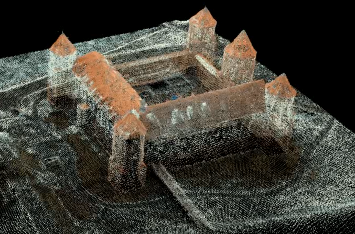
Aerial mapping & LiDAR

There are multiple ways of collection of geospatial data. LiDAR and UAS/drone technologies are key and have substantial advantages over alternative methods. We deliver the following work products to our customers

  • Point Clouds
  • Contour Maps
  • Corridor and Access Selection
  • Thermal Uprating Studies
  • Profile and Catenary Data in TL-Pro & PLS-CADD
  • Digital Elevation Models (DEMs)
  • Digital Terrain Models (DTMs)

LiDAR

LiDAR is the perfect tool when you have areas of dense vegetation or above-ground obstructions and you need precise details of current conditions. The high-density, georeferenced point clouds are excellent for providing teams with in-depth looks at existing features, clearance issues and infringement identification, and vegetation management.

UAS/Drones

Extremely cost-effective, Unmanned Aerial Systems (UAS)/drones are a rapid deployment solution for gathering site data, communicating site design, and monitoring construction activities. Our UAVs are able to cover very vast areas and stay in the air for up to 24 hours. Our partners offer the besst fixed-wing and rotary UAS with and without onboard RTK GPS.
Working together, our pilots, certified photogrammetrists, and licensed land surveyors:

  • Register the aerial photography to ground coordinates
  • Collect GPS-based photo control and check points on the photography
  • Post-process to meet client specifications
  • Perform boundary surveys

Land and Construction UAS Services:
Our platform & service packages enable persistent monitoring of urban assets in difficult to access environments. This cost effective data capture ultimately gives the client a new layer of confidence when making critical, time sensitive decisions and helps to manage big budget construction projects.

A properly managed construction site will be safer, more cost-efficient, and get completed in a timely manner. Our Partners’ UAS technology for land development can provide regular imagery and video detailing work progress and monitoring assets.

We offer an end to end package that makes it easy to get started. The payloads include mdMapper and mdLiDAR which are used to:

  • Create accurate 2D and 3D data, maps, and models
  • Conduct surveys before, during & after construction
  • Monitor progress more accurately
  • Inspect structures & job sites quickly, safely & accurately
  • Track volumes & stockpiles
  • Precisely map roads, canals, pipelines & other linear infrastructure in one line of flight with no ground control points
  • Improve job site surveillance & security
  • Reduce project waste

These improved metrics ultimately drive profits while increasing safety.

GIS and Mapping

Our partners’ UAS offer the ability to capture an huge areas in a single flight. Our post flight services process the imagery to stitch the imagery together to create an orthomosaic (a single image). Data received through a single flight can be used to manage future project development or shared with other surveyors and city planners.

We use a number of different methods to gather information, including 3D measurement tools, sensing tools such as sniffer and infrared, and conventional aerial photography. Each of these traditional survey tools utilized alone are powerful analytic tools. We can mix and match the payloads to create a more accurate and meaningful survey of the project with a resolution accuracy of 10cm.

Product/Deliverable Formats Available:

  • Aerial Surveying
  • GIS-Ready Products
  • Photogrammetry
  • Point Clouds
  • Terrain Models
  • 3D Models
  • Volumetric & Distance Measurements
  • Orthomosaic Imagery
  • Vertical, nadir, oblique imagery
  • Stockpile Calculations
  • Construction Management
  • Bank erosion areas for FEMA required surveys
  • Digital Surface & Terrain Model

Sales of Equipment

Aside from providing the mapping and LIDAR services we also offer the best UAS and LIDAR equipment for sale. You can find our recommended solutions below, also available for purchase through us – with special prices available for large orders: